Samsil-Shingle complex, 5 to 25 percent slopes
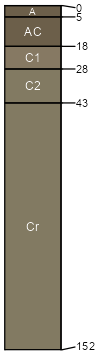
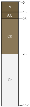
Samsil
(41%)
Shaly Foothill
Ustic Torriorthents
Well drained
Hydric: No
PAWS: 5 cm
hills
ridges
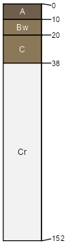
Shingle
(39%)
Shaly Foothill
Ustic Torriorthents
Well drained
Hydric: No
PAWS: 6 cm
ridges
hills
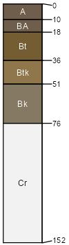
Renohill
(8%)
Loamy Plains
Hydric: No
PAWS: NA
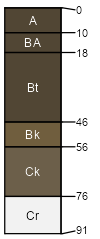
Kutch
(7%)
Loamy Slopes
Hydric: No
PAWS: NA
Gaynor
(5%)
Shaly Plains
Hydric: No
PAWS: NA
SSA
Scale
Published
Export
co641
1:24,000
1980
2023-08-24